
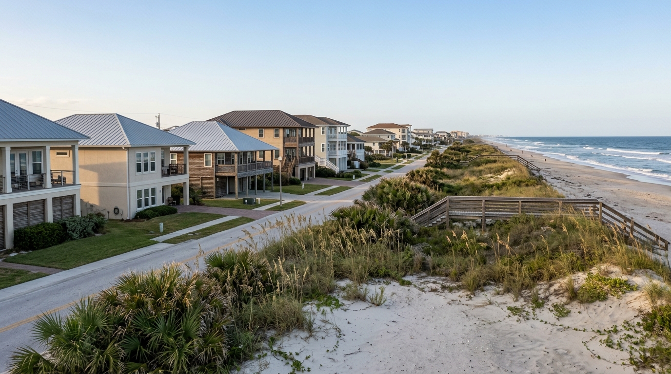
Relocating to Atlantic Beach without walking every block is manageable if you resolve the three variables that move most with the specific parcel, not with the city: the FEMA flood zone, the Duval County evacuation zone, and the property tax that resets to your purchase price at closing. Atlantic Beach is a 3.5-square-mile coastal town in Duval County with its own government and police department, and the typical home was valued near $654,577 as of April 2026, down about 3.5% over the prior year per Zillow's home-value index. A home one block off the ocean can carry a very different insurance bill and construction standard than a home directly on it. So the sight-unseen buyer's real job is parcel-level verification: pin down the exact zone letters, model the reset tax, and get a real insurance quote before writing an offer rather than trusting the listing's numbers.
Which Atlantic Beach sub-areas exist, and how do they differ?
Atlantic Beach breaks into a handful of distinct pockets, and price, flood exposure, and character shift noticeably between them.
The oceanfront blocks along the eastern edge carry the town's highest prices and the strictest building rules. These are the parcels most likely to sit in a coastal high-hazard flood zone, which changes both insurance and how the house must be built.
Selva Marina, a neighborhood dating to 1955, and the newer Atlantic Beach Country Club sit inland from the ocean around the golf course. The Country Club, built in 2014 on the site of the former Selva Marina Country Club, spurred a wave of higher-end construction, so you find newer inventory here than in the older beach cottages closer to the water.
North Beach covers the residential streets north of the town center, generally set back from the oceanfront and often in lower-risk flood zones. The Mayport Road corridor on the western side tends to offer the more attainable price points in the city.
Then there is Beaches Town Center, the walkable commercial hub straddling the Atlantic Beach and Neptune Beach line, which anchors the restaurant and shop scene for both towns.
Because per-neighborhood median prices are not published as reliably as the citywide figure, treat any single-neighborhood number cautiously and ask for a street-level MLS pull from the Northeast Florida Association of Realtors before you anchor a budget to one pocket. If you are weighing the towns against each other, it helps to compare how Atlantic Beach and Neptune Beach differ and how Atlantic Beach and Jacksonville Beach compare.
How far inland does the coastal high-hazard flood zone reach?
A FEMA flood zone is the federal risk designation for a specific parcel that drives your flood insurance requirement and how the structure must be built. It is not a citywide label, and Atlantic Beach is not uniformly high-risk.
Zone VE, the Coastal High Hazard Area, is where breaking waves of three feet per second or greater cause the most structural damage during a base flood (FEMA's coastal flood-map guidance). The important thing for a remote buyer is how narrow that band usually is: VE typically extends only a few hundred feet inland from the high-water line, and properties more than 500 feet from the ocean rarely fall into VE. Many homes one or two blocks back sit in AE or in the lower-risk X zone.
That distance matters in dollars and construction. VE parcels must be elevated on pilings so waves can pass beneath the structure, use breakaway walls, and cannot be built on fill. They also carry a 26% chance of flooding over the life of a 30-year mortgage, per FEMA's Zone VE definition. An X-zone parcel a few blocks west carries none of that mandatory burden.
Here is how the two profiles compare for a buyer choosing between an oceanfront and an inland parcel:
| Factor | Oceanfront / VE parcel | Inland / X-zone parcel |
|---|---|---|
| Typical flood zone | VE coastal high hazard | Frequently X, some AE |
| Flood insurance | Mandatory with a federal mortgage | Not required in X, still recommended |
| Construction rules | Pilings and breakaway walls | Standard slab permitted |
| 30-year flood odds | 26% chance | Lower; X sits above the 500-year level |
The failure mode is assuming "beach town equals uniform risk" and buying oceanfront without pricing the VE premium. For a deeper walk through the map, see how FEMA flood zones work across Atlantic Beach.
What is the difference between a FEMA flood zone and a Duval evacuation zone?
A FEMA flood zone and a Duval County evacuation zone are two different maps that remote buyers routinely conflate. The flood zone drives your insurance and construction requirements year-round. The evacuation zone drives only one thing: when you are ordered to leave during a storm.
Duval County uses a lettered evacuation system, A through F, and the zones are built from a tiered look at storm surge, freshwater flooding, and isolation (JaxReady, the county's emergency-preparedness resource). Zone A areas are the most vulnerable and are evacuated first, including manufactured and mobile homes. The vulnerability generally rises toward Zone A and eases from B toward E, with Zone F covering rainfall-driven flood areas.
Duval's evacuation zones are more complex than most counties' because of how the St. Johns River system interacts with the Atlantic, and the county's lowest-lying land runs along the coast and the rivers. So a parcel can sit in the lower-risk X flood zone yet still fall in an early evacuation zone, or vice versa. You need both letters for the same address, from two separate lookups, before you can judge the true storm picture.
Why is my property tax bill higher than the seller's after I close?
Your Atlantic Beach property tax bill is higher than the seller's because Florida's assessed value resets to your purchase price the year after you buy. The seller's line on the MLS reflects years of capped assessments, not what you will actually owe.
Florida's "Save Our Homes" amendment caps annual assessment increases at 3% for homesteaded properties, so a long-tenured owner's taxable value can sit far below current market value. When you close, that cap resets and the taxable value jumps toward your purchase price. Budgeting off the listing's tax line is the single most common carrying-cost mistake a relocating buyer makes.
Duval County's total millage runs about 17.86 mills for the 2025 tax year, one of the higher combined rates in Northeast Florida, per Momentum Realty's tax breakdown, of which roughly 6.34 mills fund schools. As a rough model, a homesteaded $350,000 home with the standard exemption lands near $5,518 a year, about $460 a month, an effective rate close to 1.58% of price.
For 2026 the total homestead exemption rose to $51,411 from $50,722 in 2025 under Amendment 5's inflation adjustment. You must file for homestead by March 1 of the year after you buy. Taxes come due November 1, with a 4% discount for paying in November that steps down to 1% by February.
A separate proposal from the DeSantis administration to exempt the first $250,000 of homesteaded value from non-school taxes passed the Legislature on June 2, 2026, but it is not law; it needs 60% voter approval in November 2026. Do not budget around it. To model the reset before you offer, compare how Duval and St. Johns County property taxes differ and read up on the homestead exemption on higher-value Florida homes.
What will insurance and carrying costs run before you write an offer?
You should price two separate policies for a coastal Atlantic Beach home before writing an offer: homeowners insurance and, in most cases, flood insurance, because a standard Florida homeowners policy does not cover flood damage.
The average Florida homeowners policy now runs roughly $5,500 to $11,000 a year, weighted heavily by county and proximity to the coast (a mid-2026 GreatFlorida estimate). Atlantic Beach's parcel-level premium is not published as a city average, so the only reliable number is a quote from a licensed Florida carrier or the Florida Office of Insurance Regulation rate-comparison tool for ZIP 32233.
Nearly every Florida policy also carries a separate hurricane deductible, typically 2% to 5% of dwelling coverage per named storm, so on a $700,000 dwelling limit you could face a $14,000 to $35,000 out-of-pocket hit before coverage responds. That is a budgeting line, not a footnote.
Flood insurance is priced separately through the NFIP or a private carrier. Zones V and VE carry premiums often two to four times an AE parcel's, per FEMA-aligned coastal guidance, which is why the oceanfront lifestyle premium shows up twice: once in the price and again every year in the policy. Even in an X zone, FEMA's flood-zone resource treats flood coverage as recommended rather than required, and it is usually inexpensive there.
Two documented upgrades genuinely lower the homeowners premium: a newer roof with impact-rated windows can trim hundreds of dollars a year, and a wind-mitigation inspection documenting roof shape, opening protection, and secondary water barriers currently delivers the larger reductions available to Florida homeowners. For the full monthly picture, see what flood insurance costs on Atlantic Beach oceanfront homes and this breakdown of the true monthly cost of owning here.
How can you verify a specific parcel from a distance?
You can confirm the three variables that matter most from anywhere with four public lookups tied to the exact address, not the city. Verifying the parcel, not the town, is the whole discipline of buying here sight unseen.
Start with the FEMA Flood Insurance Rate Map or FloodSmart address lookup to pull the parcel's zone letters, VE, AE, or X. For an older or elevated home, an elevation certificate on the specific Atlantic Beach home tells you where the finished floor sits relative to the base flood elevation, which drives both risk and premium.
Next, run the address through Florida Disaster's "Know Your Zone" or the JaxReady evacuation map to get the A-through-F letter. Remember these are two different answers from two different maps.
Third, look up the current assessment on the Duval County Property Appraiser site, then model your reset bill off your intended purchase price rather than the seller's capped figure. If you want the city's floodplain administrator to confirm construction requirements on a VE parcel, the City of Atlantic Beach can answer that directly.
Fourth, get a written insurance quote for that address and a flood quote from the NFIP before your inspection period ends. A remote purchase is defensible when those four documents agree with the listing; it is risky when they do not. For a broader framework, read about buying a beach home sight unseen safely, and when you are ready to shortlist, browse current Atlantic Beach homes for sale.
Frequently Asked Questions
How can I safely choose an Atlantic Beach neighborhood if I can't visit in person?
Focus on layering public data rather than relying on impressions: pull FEMA flood map panels for specific parcels, review Duval County Property Appraiser records for lot size and improvement values, and cross-reference aerial imagery against street-level views to assess proximity to the Intracoastal versus the ocean side. Neighborhoods within Atlantic Beach's small footprint can shift meaningfully in elevation, flood exposure, and street character within just a few blocks, so parcel-level research matters more than neighborhood-level generalizations. A licensed agent with access to historical MLS data can also show you how list-to-sale ratios and days on market have behaved in specific pockets, which tells you something real about demand and condition expectations before you ever step on a plane.
Is the whole city of Atlantic Beach in a flood zone, or does it vary by parcel?
It varies by parcel, sometimes dramatically. Atlantic Beach sits on a barrier island, and FEMA flood zone designations range from high-risk AE zones, which carry a mandatory flood insurance purchase requirement for federally backed loans, to moderate-risk X zones where that requirement does not apply. Two homes on the same street can carry different zone designations depending on their precise elevation and distance from drainage features, so checking the FEMA Flood Map Service Center using the property's specific address is the only reliable method.
What is the difference between a FEMA flood zone and a Duval County evacuation zone?
They measure different risks and are managed by different agencies. A FEMA flood zone reflects the statistical probability of flooding based on elevation, hydrology, and storm surge modeling, and it directly determines whether a lender requires flood insurance. A Duval County evacuation zone, assigned by Duval County Emergency Management, indicates how early local officials would order residents to leave ahead of a hurricane, with Zone A being the highest-priority evacuation tier; a property can sit in a low FEMA flood zone but still fall in an early evacuation zone because of its vulnerability to storm surge before significant rainfall even occurs.
Why is my property tax bill higher than the seller's after I close?
Florida's Save Our Homes cap limits annual assessed value increases to 3 percent or the rate of inflation, whichever is lower, for homesteaded properties, which can allow a long-term owner's taxable value to fall well below market value over time. When a property changes hands, the cap resets and the county reassesses the home at or near the purchase price, which is public record. If the seller held the home for many years under homestead exemption, the gap between their capped assessed value and your new assessed value can be substantial, and your first full tax year bill will reflect that reset.
How much does homeowners insurance cost for a coastal Florida home?
Coastal Florida insurance premiums are among the highest in the country, and the range for a single-family home in Atlantic Beach is wide enough that a general figure would be misleading, variables like year built, roof age and shape, wind mitigation features, construction type, and flood zone designation all move the number significantly. What you can control is ordering a wind mitigation inspection before you close, because documented features like a hip roof or reinforced roof-to-wall connections can produce meaningful premium credits with most carriers. Getting bindable quotes from multiple admitted and surplus lines carriers during your inspection period, not after closing, is the only way to understand your actual cost before you are committed to the purchase.